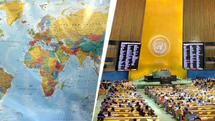
New York (GNP): The United Nations General Assembly (UNGA) voted on Friday to adopt a resolution, driven by a group of African countries, endorsing a new world map that enlarges the African continent while reducing the visual size of North America and Europe. The measure passed with the backing of 164 countries, while the United States voted against it and six other states abstained.
The resolution frames the shift as a move toward a more accurate representation of the world’s landmasses, describing the new map, known as the Equal Earth projection, as a relevant option for improving the accuracy of global cartographic depictions. It calls on member states to move away from the traditional Mercator projection, a system devised by Flemish cartographer Gerardus Mercator in 1569 for maritime navigation rather than for representing the true proportions of continents.
That distinction lies at the heart of the resolution’s rationale. The Mercator projection prioritised the accurate depiction of shapes and angles, but in translating a three-dimensional globe onto a flat map, it inflated northern regions and compressed those near the equator, making Europe and North America appear disproportionately large while shrinking Africa and South America.
The Equal Earth projection, developed by a group of cartographers and launched in 2018, corrects that imbalance, enlarging Africa, Latin America, South Asia and Oceania relative to the older standard.
Togo, which led the push for the resolution, argued that maps carry influence well beyond geography. Foreign Minister Robert Dussey said that maps shape education and public perception, and that inaccurate representations risk being passed down through generations if left uncorrected.
Also Read: Six Months of War Leave Iran More Confident, US Intelligence Finds
France, a co-sponsor of the resolution, announced that it would abandon the Mercator projection altogether. Foreign Minister Jean-Noel Barrot said the old map gave outsized visual prominence to the United States, Russia and China compared with Africa, Latin America and Southeast Asia, and noted that Greenland appears on it as almost the size of Africa. The French move comes as Paris works to repair relations with African nations, including several former colonies with which ties have remained strained.
The United States rejected the resolution, arguing that such debates undermine the institution’s credibility at a time when more pressing global problems demand attention. Representative Yaryna Ferencevych said the body was instead spending its time on centuries-old map projections tied to discussions of reparations and cognitive justice.
Robert Dussey said, “Maps guide education, nourish the imagination, and influence collective perceptions.”
Jean-Noel Barrot said, “Correcting a distorted representation is already an act of truth.”

Managing Editor at Global News Pakistan (GNP), with a Bachelor's degree in International Relations from Riphah International University, graduated with a Gold Medal. Reach out at sabahtareengnp@gmail.com