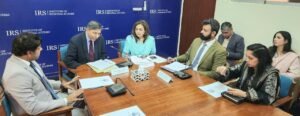
Islamabad-: The Inter-Islamic Network on Space Sciences and Technology (ISNET), established under COMSTECH, promotes cooperation in space sciences and technology among OIC member states. With a mandate to build capacity, facilitate knowledge exchange, and support the peaceful use of space for sustainable development, ISNET serves as an important platform for regional collaboration. Pakistan’s national space agency, SUPARCO, is not only a founding member but also the host organization of ISNET, playing a pivotal role in advancing its initiatives.
In collaboration with SUPARCO, ISNET is organizing various capacity-building activities in 2025 to strengthen the technical expertise of member states in applying space science and technology for sustainable development.
Two international training courses are scheduled during September 2025. The first, Programming for Web GIS Development Using Open-Source Technologies, will be held from 22–26 September 2025 in Lahore, Pakistan. The program will equip participants with essential skills in programming, mapping, and Geographic Information Systems (GIS) through modules on cartography, Web GIS, spatial databases, user interface development, spatial analysis, and map/report generation. Recognizing that Web GIS has become a powerful tool in addressing contemporary challenges—from disaster management and climate change monitoring to urban planning, agriculture, and natural resource management—the training places strong emphasis on practical applications. To further enrich the program, an international expert from Azerbaijan will deliver a special session on “GeoServer 2.0 for Space Applications: Leveraging Open Data, Cloud AI, and Machine Learning for Intelligent Earth Insights.” Delegates from Sudan, Senegal, Iraq, Tunisia, Türkiye and Libya are attending this training.
The second course, Space-Based Disaster Management – Shifting Focus from Reactive to Proactive Approaches, will take place from 29 September–03 October 2025 in Islamabad, Pakistan. The course will provide hands-on training in remote sensing applications and rapid damage assessment techniques, with a focus on disasters such as floods, earthquakes, landslides, and droughts. It will also include flood hazard assessment using advanced modeling tools like the HEC-RAS 2D Model. Participants from Sudan, Senegal, Iraq, Tunisia, Türkiye, and Libya will attend the training.
Through these initiatives, ISNET aims to strengthen collaboration among member states and promote the peaceful use of space science and technology. SUPARCO’s partnership in these programs reflects Pakistan’s continued commitment to supporting regional cooperation and capacity building in space applications.